Evenlode Landscape Recovery Project
Indicative funding required
£300m over the next 20 years
Funding already secured
~£116m from public funding, private capital and initial ecosystem service sales (June 2026)
Types of funding required
Corporate Buyers, Institutional Capital
Key information
Lead organisation
North East Cotswolds Farmer Cluster CIC
Local Planning Authority (LPA)
West Oxfordshire District Council
Key partners
Natural England, Environment Agency, Oxfordshire County Council, Network Rail, Thames Water and Scottish and Southern Electricity Networks (SSEN)
Total area
3,031 ha (2,769 ha creation, 966 ha enhancement)
Ecology and character
Habitat type availability
Habitat created and enhanced across four main types: wetland and water (floodplain wetland mosaics, fens, pond, temporary water storage and rivers); grassland (lowland meadows, calcareous grassland, neutral grassland and hay meadows); woodland and scrub (mixed deciduous and other woodland, wet woodland, wood pasture, and traditional orchards); and linear and boundary features (native and species-rich hedgerows)
Key ecological outcomes
Priority species include water vole, curlew, eel, water-crowfoot chosen as emblematic indicators of catchment health. Key ecological benefits include water quality enhancement, flood risk reduction, carbon sequestration, bioabundance and biodiversity, soil health and landscape connectivity
National Character Area (NCA)
Cotswold National Landscape
LNRS alignment
Delivers 85% of LNRS Priority Measures
Ecosystem services and wider benefits
Registered standards
Statutory Biodiversity Net Gain units; Woodland Carbon Code; Isometric Improved Soil Management Protocol; BSI Flex 700 series
Available ecosystem services
Biodiversity Net Gain units (>2,500 units); Woodland Carbon Credits (>650,000 tC02e); Water Quality (>500,000 kg Nitrate and Phosphate removed); Natural Flood Management (>1,000,000 m3 of water stored per annum)
Wider benefits
Comprehensive package of volunteering opportunities, enhanced access for local communities, and flood resilience for downstream communities.
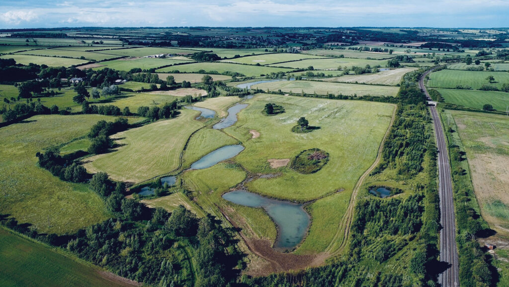
The Evenlode Landscape Recovery Project will enhance how land and rivers work together across the Evenlode, Dorn and Glyme catchments, improving existing habitats and creating new woodland, wetland and riverside habitat.
Each participating farm is committing around 10-35% of its less productive land to the project, land that many farmers report they are losing to flooding. The project will bring this land back into use to restore and improve riverside habitats. This will help keep land workable for longer (less waterlogging and/or compaction), reduces erosion, and improves yield reliability by keeping water where crops and grassland can use it.
Another objective is cutting pollution getting into rivers by keeping soil, nutrients and inputs on the farm instead of being lost to runoff, which protects productivity and can reduce costs. It also lowers the risk of pollution incidents, enforcement action and remedial work. For the environment, cleaner water supports wildlife, reduces algal blooms and improves river health for communities downstream.
Focusing restoration on flood-prone land helps nature do what it is good at: slowing water, improving water quality and supporting wildlife. Delivered across around 50 farms, this approach will reconnect habitats and restore more natural river processes at a landscape scale, bringing lasting benefits for nature, community and flood resilience.



.png)